

Description
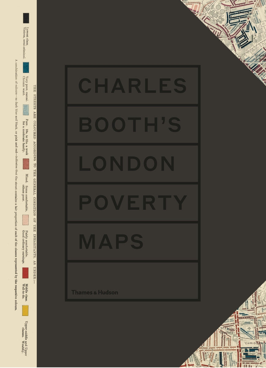
Discover the rich historical tapestry of late-19th-century London with *Charles Booth’s London Poverty Maps*. This essential publication, first issued in 2019 by Thames and Hudson Ltd, compiles Booth's groundbreaking social and economic survey into a single comprehensive volume. Dive into Booth's meticulous research, which identified that a staggering 35 percent of Londoners lived in abject poverty, illuminating the stark contrasts between the city's various social classes. With an innovative approach, Booth and his dedicated team engaged directly with Londoners from diverse backgrounds, capturing their raw voices and experiences through interviews and statistical analyses. The collection features over 450 notebooks filled with striking anecdotes and insights that highlight the realities faced by people in different trades and communities. The meticulously crafted, hand-colored maps serve as visual representations of the socio-economic landscape, categorizing neighborhoods from wealthy enclaves to impoverished areas. Accompanying essays provide context, expanding upon the significance of this pivotal survey and its ongoing relevance in understanding urban poverty. With thematic essays and evocative period photographs, *Charles Booth's London Poverty Maps* offers a compelling look into the past, reflecting the vibrancy and challenges of London's inhabitants. Perfect for historians, educators, and anyone fascinated by social justice and urban studies, this publication is not only a visual delight but a vital resource for exploring the complexities of life in Victorian London.